UNITRACE GPS TRACKING
UniTrace is a transport monitoring and supervision system designed for real-time vehicle monitoring. Continuous monitoring and supervision helps reduce vehicle running costs and save working hours for people. The system allows to monitor all of the key vehicle parameters: current location, route history and changes, remaining fuel and fuel consumption, working hours and many other parameters. UniTrace allows for live monitoring of the vehicles that are displayed on the map and analysis of their operation parameters using various reports and tools. The system is based on an interpretation of the information received via a GPS satellite network and sending that information via mobile networks (GSM) principle. The GPS receiver receives the signals from road satellites located in an accessible zone, processes the received signals using integrated algorithms and displays the information of the current location of the user, i.e., their coordinates, moving speed, destination and other parameters. The UniTrace GPS monitoring and supervision system server receives the data via a GSM network, therefore, the user can get the information on the location of a monitored object (vehicle, other device or a person), route history of the above mentioned object and other telemetric data by signing in to our system using an internet browser or mobile applications. The signals sent by the GPS satellite are able to reach any location on the earth at any time, irrespective to the weather conditions.
BENEFITS OF THE PROJECT:
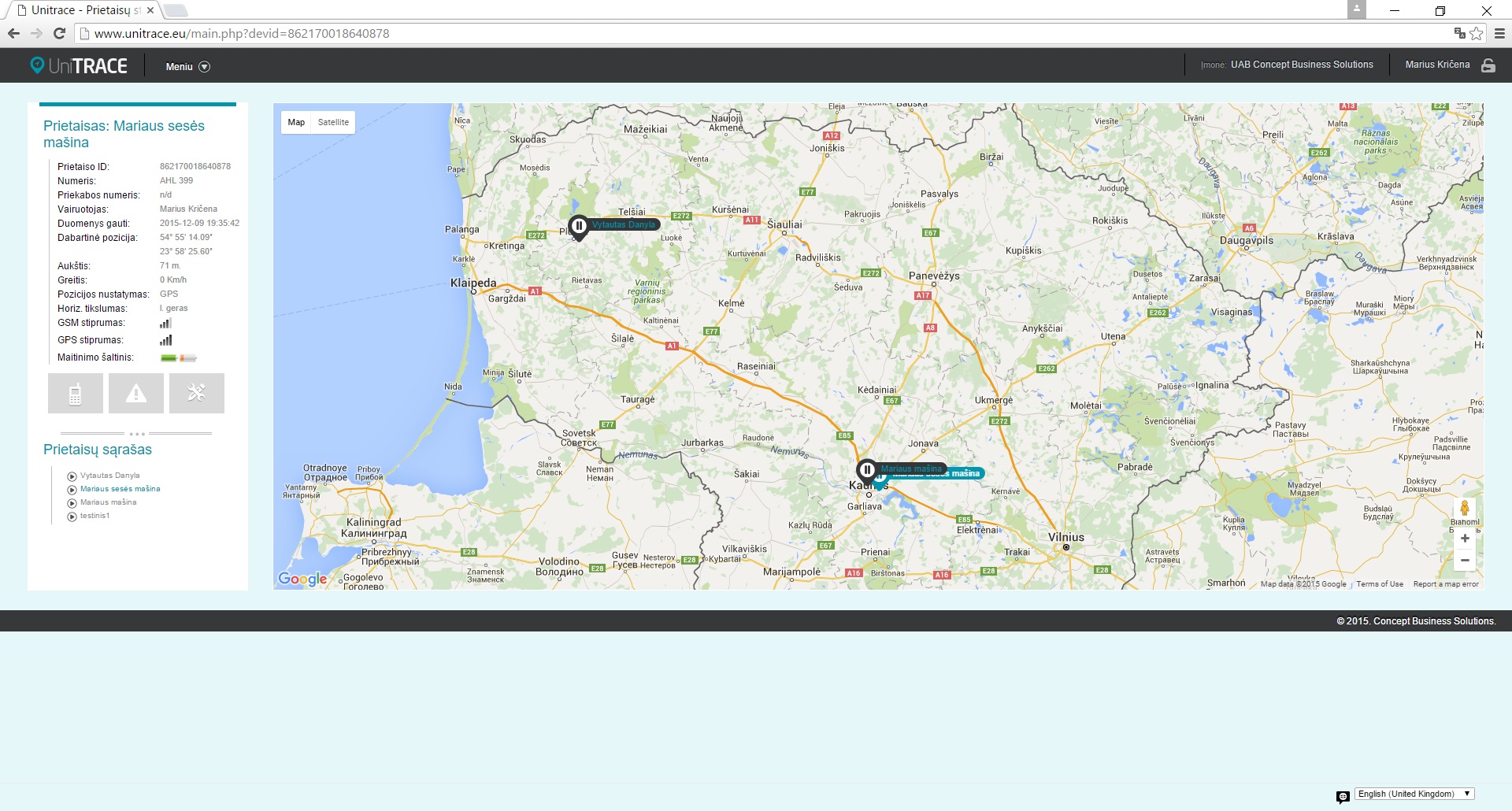
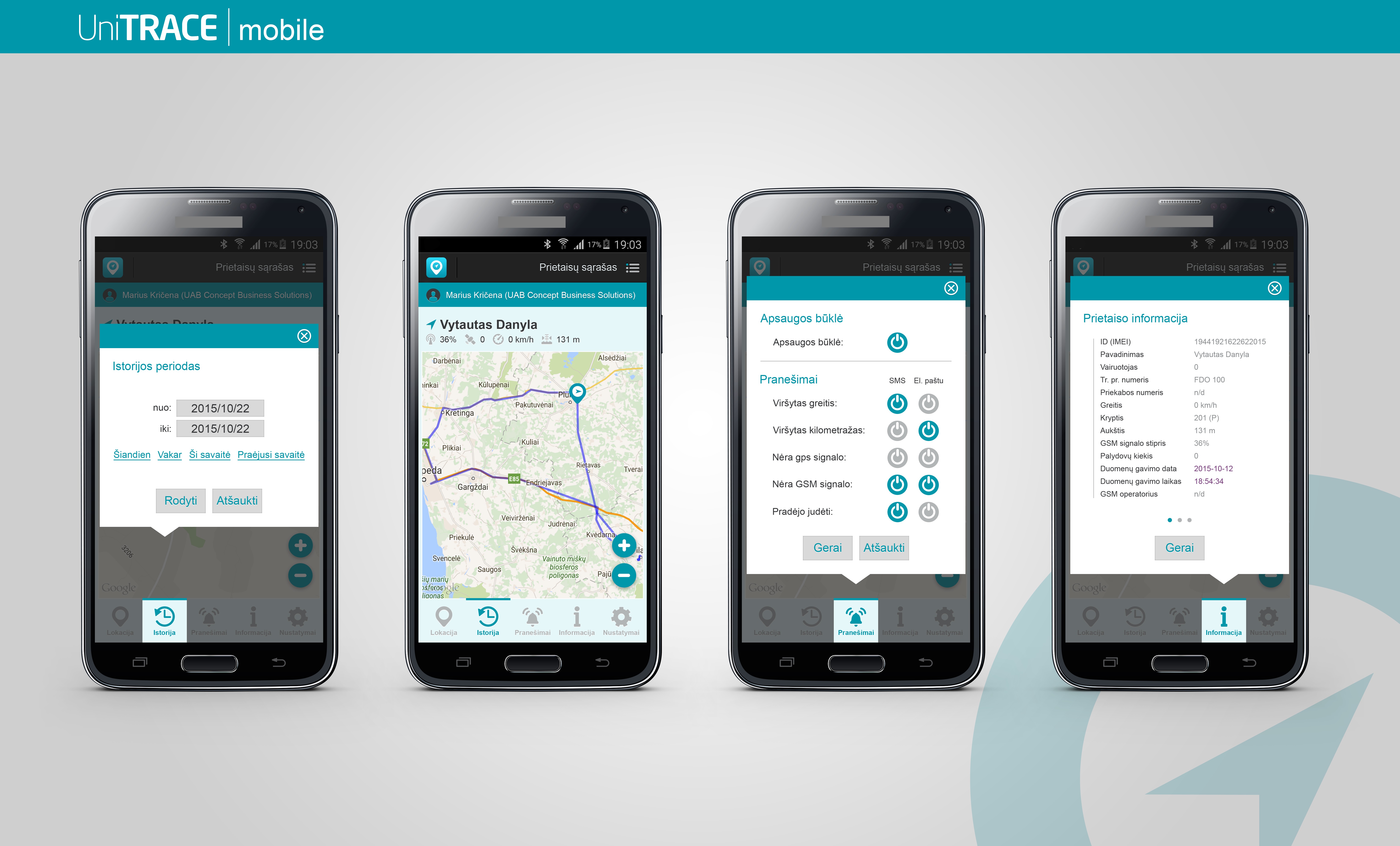
• Monitor the location and condition of the objects in real time. The location of the objects are displayed on a map, the location of the objects is updated constantly. Together with the above mentioned parameters, the system also displays a variety of condition parameters (speed, altitude, movement direction, and other telemetric data).
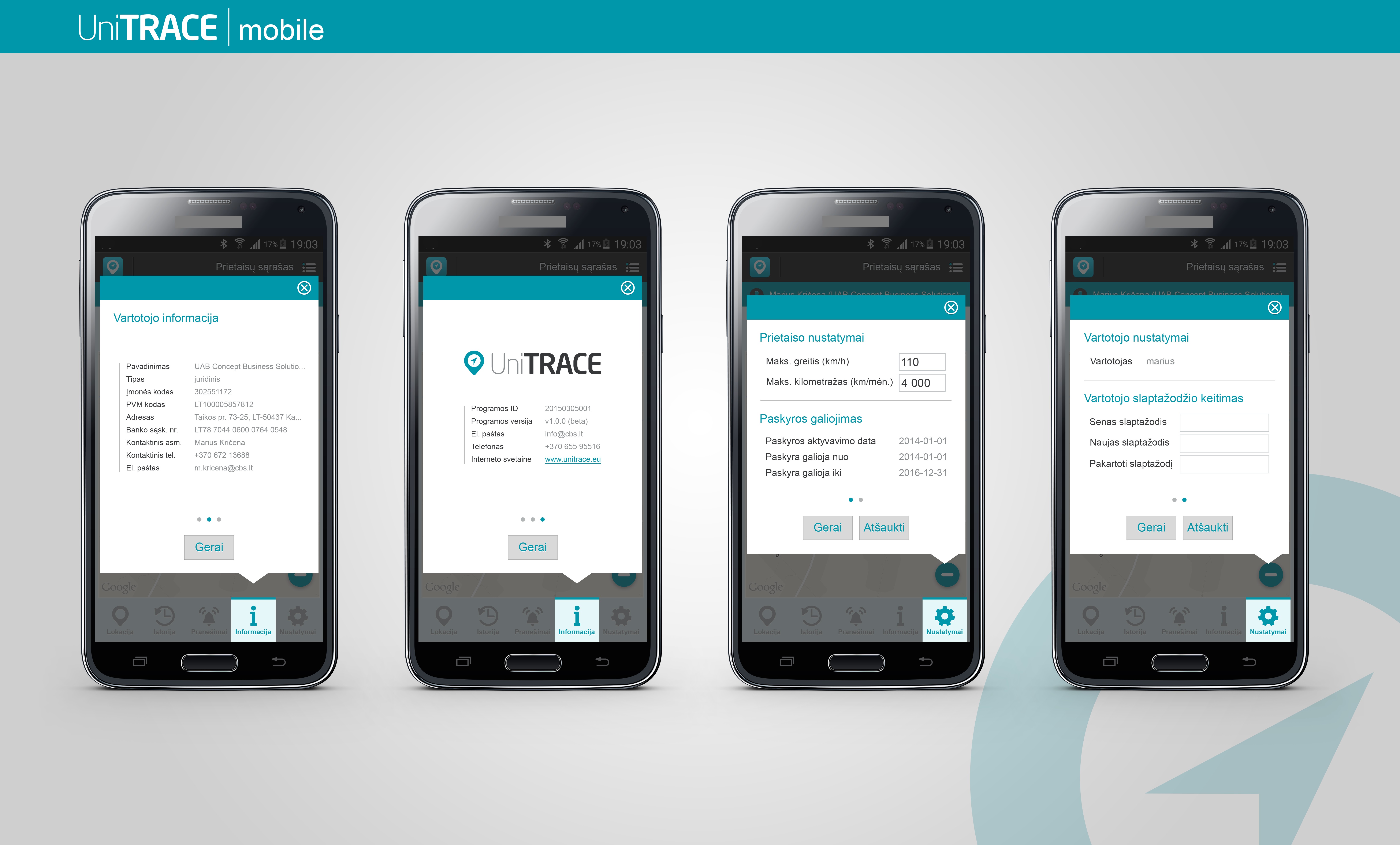
• Form condition reports for the objects that are of interest to you. The system report formation tool enables the possibility to receive reports on the general data of the monitored object, clear information on the locations visited by the objects and other type of reports.
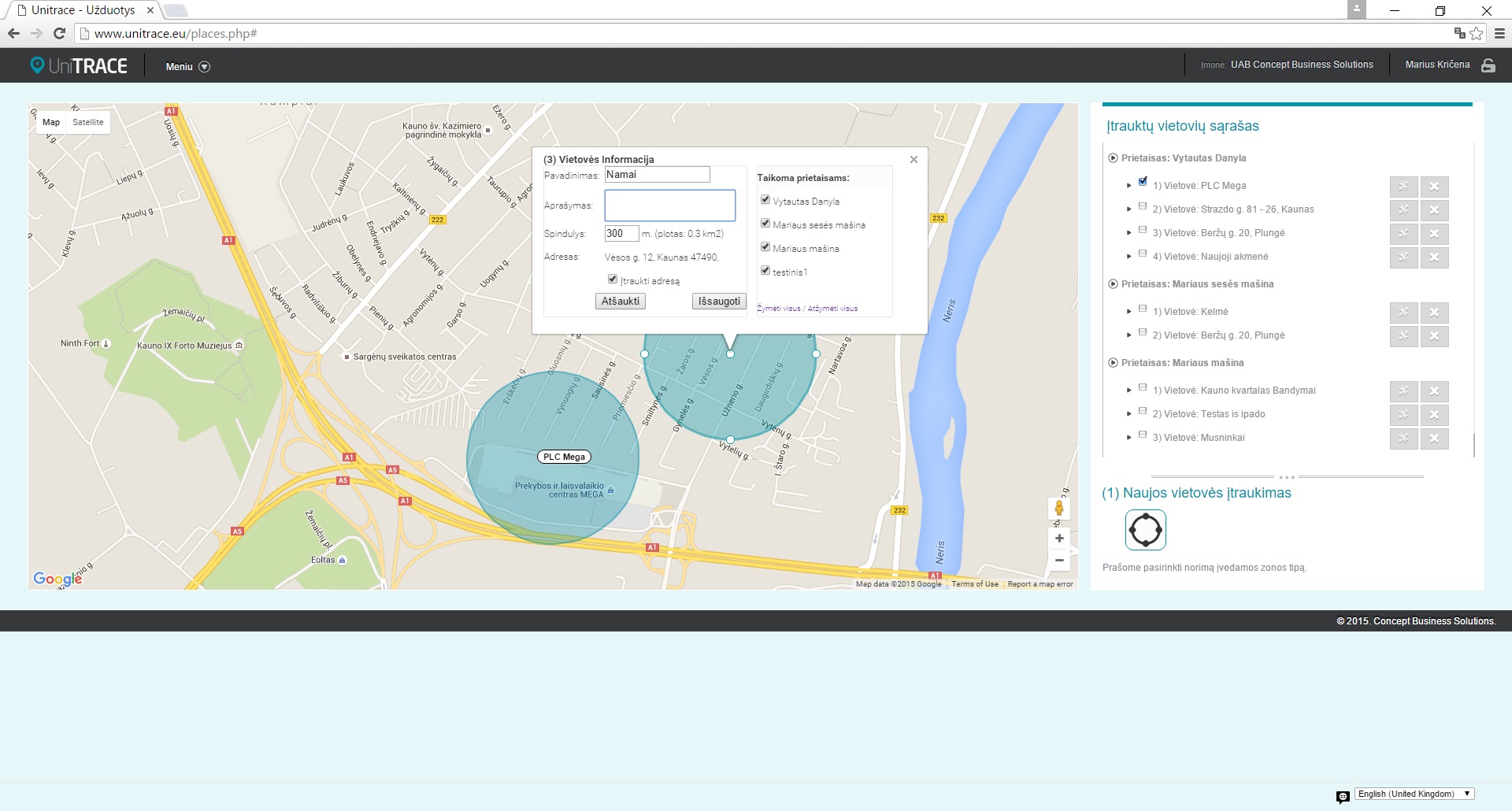
• Register information on the locations that are of interest to you. All of the information related to the locations are displayed in a graphical form by marking these location on the map. Afterwards, the information can be used to analyse the attendance of the monitored object at appropriate locations.
• Receive notifications for important events. Where necessary, the system will notify the users automatically on all of the important events relating to the monitored object, such as: moving, exceeding the maximum allowed speed or monthly mileage, loss of a connection with the tracing device and other. Depending on the selected plan, the notifications can be sent via (SMS) short messages and/or e. mail.
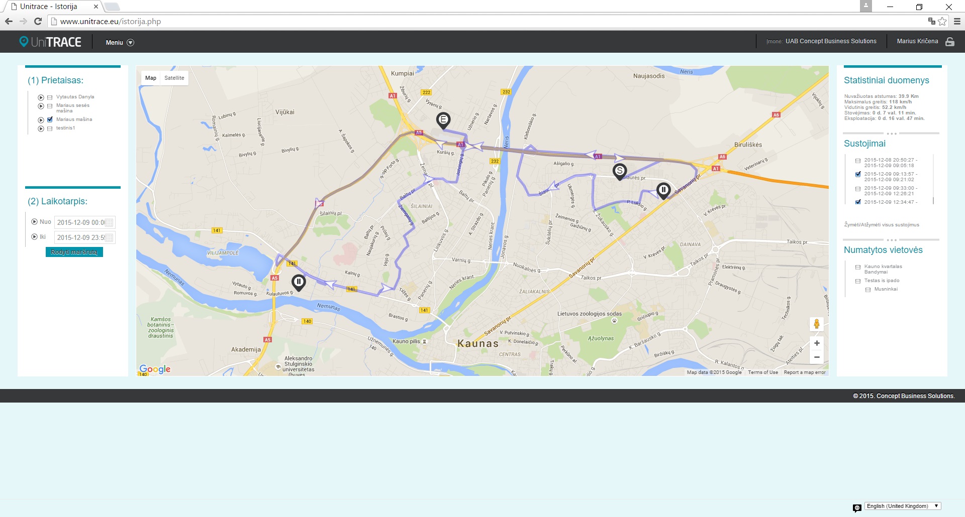
• Analyse the movement history of the object. The movement history of the selected object is displayed on the map together with the movement trajectory during the specified time period. Together with the above mentioned data, the system also displays all of the registered stops and the duration of the stops of the object. Using this data together with the locations registered on the system, you can form a very clear view on the visits of the object at these locations.
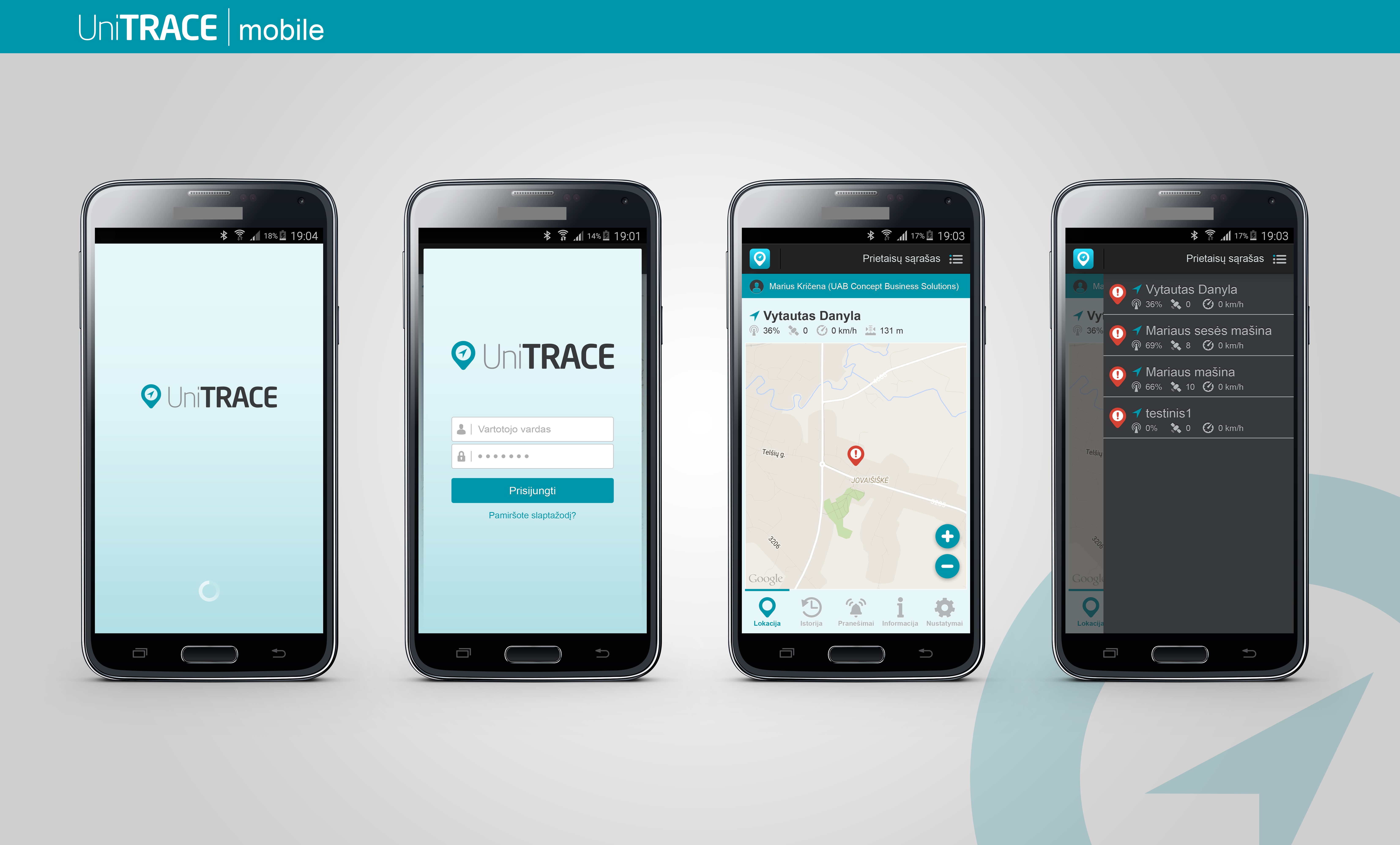
• Monitor the objects that are of interest to you on your mobile device. By using specifically designed apps for both your Android and Apple devices, you can access the UniTRACE system using your mobile devices. By using these apps, you can get a quick and convenient view on the condition of the objects that are of interest to you in real time, view the movement trajectory of the objects, manage the notification for important events settings, and also perform other actions.
Task
Implement a GPS/GPRS based monitoring and management system that allows the users to monitor the location, movement trajectory and other instantaneous parameters of the monitored objects in real time from any location at any time, and also to allow viewing of the movement trajectory during a specified time period, stops and their durations, forming reports on visits at the locations that are of interest and other important reports. The system has to be accessible via internet browsers and mobile devices.